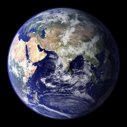
How do you calculate your age? You simply subtract your birth year and the current year. But when it comes to determining the age of the sprawling sphere which we call home, Earth, it becomes a bit trickier. Let’s explore what science has to say about the age of the Earth.
The planet’s age couldn’t be guessed by anyone before the process of radiometric dating came into play. In 1898, the pioneer of radiology, Marie Curie discovered the phenomenon of radioactivity. The atoms either decay or lose energy by emitting radiation in the form of electromagnetic waves or particles. Later, in the year 1904, Ernest Rutherford, the famous physicist determined how this decay could let them explore the age of old rocks.
With this exploration, Arthur Homes, who was completing his geology degree in London, acted as a helping hand by developing a new technique of dating rocks using the uranium-lead method. He applied this technique to the oldest rock and got to know its age. Applying a similar technique to calculate the age of the Earth made him reach the conclusion that the Earth was at least 1.6 billion years old.
But wait, this is not the actual age of the Earth! Earth’s age has always been hotly debated among scientists over the years. That is why several revisions have been made. Later, in the 1920s, an unknown scientist declared that Earth’s age was approximately 3 billion years. This suggested that the Earth was even older than the universe, which itself was thought to be 1.8 billion years old.
Later, the scientists declared that radiometric dating of the fragments from the Canyon Diablo iron meteorite was the best estimate for calculating the age of the Earth. From those fragments, they got to know that the true age of Earth was 4.56 billion years.
Since then, scientists have been using radiometric dating to determine the age of extraterrestrial objects such as Earth, meteorites, space rocks and moon rocks. For many years, scientists have tried to determine the exact age and now that they have discovered its age using the radiometric dating, they are using it for several other space objects as well.
Geology isn’t limited to the study of rocks; it also encompasses the study of how these rocks change over time and often gives us clues about Earth’s history, and it provides geologists with information about plate tectonics, Earth’s climate over the years, and how life has evolved on Earth since its inception.
Geological wonders never cease to amaze people. From subtle geochemical changes to massive volcanoes, there is so much information that you can’t help but feel fascinated at the marvels of our home planet. To help you see what we mean, we’ve listed down some of the most fascinating geological facts that will leave you smitten! Let’s dive into them right away!
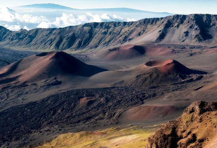
Potential Volcanoes
How many times have you watched movies where volcanoes erupt and cause mass destruction? And most of these movies are based upon facts. The Mount Vesuviusvolcano at Pompei is a perfect and riveting example. Well, what would you do if we tell you that there are as many as 18 volcanoes across the globe that can possibly erupt at ant time? What’s worse, all 18 of these potential eruptions are situated in Hawaii, Alaska and the West Coast of the United States!
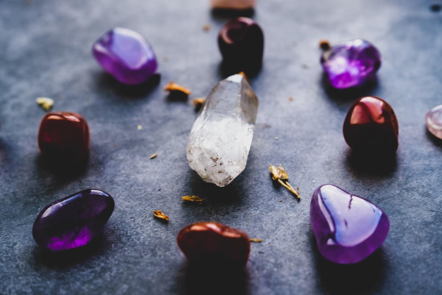
Rubies and Sapphire Are the Same Minerals
Rubies and Sapphires are two of the most widely known and commonly used gemstones around the world. A ruby is known for its characteristic deep red color and sapphire for its breathtaking blue color. However, did you know that both Ruby and Sapphire are the same minerals? They are both made from the mineral corundum. Corundum has a basic chemical formula Al2O3. What makes the two gemstones different are the traces of other components. Ruby gets its characteristic red color from traces of iron, whereas Sapphire gets its blue color from traces of titanium or chromium.
Diamonds Come in a Variety Colors
Most diamonds are transparent; however, thanks to the movie Titanic, people are more aware that colored diamonds exist too. Although colored diamonds are extremely rare, you’ll be surprised to know that diamonds come in a variety of colors, including brown, blue, orange, yellow, green, purple, pink, red, milky-white, gray and even black. Of all the colors, red diamonds are the rarest and the most valuable!
Yellowstone is Not a Supervolcano
There’s been a lot of hype around the Yellowstone volcano. People speculate that it is a supervolcano that will erupt and destroy the whole of the U.S. If you’re one of the believers of that theory, we hate to break it to you that Yellowstone probably won’t erupt to that magnitude.
The quantity of magma beneath Yosemite is quite small at present. Even if it does erupt, which it is not likely to, it will not destroy America. The result will probably be some minor damage in its surrounding areas.
According to experts, the chances of Yellowstone erupting as a supervolcano in the next thousand years are as low as 0.00014%. You might have a better chance of winning the lottery.
Glaciers are Causing Earthquakes in Great Lakes Region
You might think that the fault lines on the west coast arethe only area where earthquakes can occur in the U.S., but they are quite common in the Great Lakes region, and this is because of the glaciers in the region. These earthquakes are a result of Earth’s rebounding after being squashed by the glaciers from the last ice age.
No Country Owns Antarctica
Antarctica is one of the few areas on this Earth that remains uninhabited (if you don’t count a few scientists and lots of penguins). If you’ve ever wondered which country owns Antarctica, you’ll be surprised to know that no country owns this part of the world. It is a neutral zone that is not owned by anyone.
However, it is difficult to say how long that status will remain, as due to the melting of glaciers, numerous oil reserves in the continent have been exposed. It’s a situation that keeps developing and something to keep an eye on for sure.
Antacids are Chalk
Many people complain that antacids taste and feel like chalk in the mouth. Well, that is because antacids are chalk! Chalk is typically calcium carbonate, and that’s what antacids are made up of. So, if you think you’re gulping down a chalk mixture, that’s what you’re probably doing!
People Automatically Float in the Dead Sea
This is because the water of the Dead Sea has such a high salt concentration that the water is a lot denser than the weight of humans. Humans, being less dense, automatically float over the surface of the Dead Sea, without even having to try!
Asia and America will Form a Supercontinent
This geological plan might fascinate you the most. Scientists predict that in about 200 million years, America and Asia will collide and form a single supercontinent that will be centered at the North Pole. Scientists have even given a name to this supercontinent – Amasia!
The North Pole and the South Pole Can Reverse
We’ve grown up with the fact that the North Pole forms the upper extreme of the Earth while the South Pole forms the lower extreme. What if we tell you that our magnetic poles often reverse? The South Pole and the North Pole reverse their magnetism, flipping the directions around. It is predicted that it might do so once again in 1,000 – 10,000 years.
San Francisco and Los Angeles Might be Neighbors in the Future
The Earth is constantly slipping along the fault lines of San Andreas at a rate of two inches per year. This means that in the next 15 million years, San Francisco and Los Angeles will become neighbors.
20% of Earth’s Freshwater is in the Great Lakes
You’ll be amazed to know that 20% of the entire world’s fresh water is in the Great Lakes. This percentage doesn’t include the polar ice or underground aquifers.
Closing Word
While we may not realize it, our Earth is constantly changing. We may think that we’ve managed to uncover most of the Earth’s secrets, but you will be amazed to know how little you know. The Earth holds untold secrets that will take us almost forever to find, and that too might not be enough to uncover it all! These geological facts are just a few of the long list of known facts. There is so much more to know!
Located nearly 93 million miles or 1 Astronomical Unit (AU) away from the Sun, Earth is the largest of the terrestrial planets—or the four rocky planets closest to the Sun in our solar system. (The rest are gas giants).
This third rock from the sun is the only planet in our solar system that is not named after Greek and Roman gods and goddesses. The name Earth is at least 1,000 years old and is an English/German but that is gradually slowing. This deceleration is almost imperceptible but has the effect of lengthening our days. It is happening so slowly, though, that it could be 140 million years before the length of a day increases to 25 hours.
First photo of Earth from space which shows the south polar ice cap
The first photo of Earth from space was taken on October 24, 1946, by a V-2 test rocket launched from New Mexico. From there, we turned our attention to the closest body in our solar system: the Moon.
While the Moon, Earth’s only natural satellite, is only the fifth largest in our solar system, in terms of percentage of the size of the body it orbits, the Moon is the largest satellite of any planet in our solar system.
Astronomers hypothesize that the Moon was formed 4.5 billion years ago, not long after Earth, from the debris left over after a giant impact between Earth and a Mars-sized body.
The first unmanned spacecraft to reach the Moon was one from the Soviet Union’s Luna program in 1959, and the first manned lunar landing being Apollo 11 in 1969. The last manned spacecraft was Apollo 17 in 1972, and since then, the Moon has only been visited by unmanned spacecraft.
NASA started to plan to resume manned missions for the construction of a lunar base by 2024, but the program was canceled in favor of a manned asteroid landing by 2025 and a manned Mars orbit by 2035. But in 2019, NASA started making plans for not only going back to the moon by putting the first woman there and even more exciting, manned trips to Mars!
Learning about gems and minerals is exciting and informative
Need a hobby? How about collecting gems and minerals? Mineral collecting is both exciting and informative. Exciting because of the intricate colors and shines the different varieties have and informative because one must learn their geology in order to really appreciate them. It is a historical trip back in time to discover the hidden gems of the earth.
If you are a beginner who is looking forward to creating a collection of your own, you don’t necessarily have to start out with making huge discoveries of these beautiful gems. You can start right at the beach or your very own backyard if you have one!
Here is a guide on how to start your own mineral and gem collection as you explore the intriguing world of these minerals and rocks.
Start with General Research
The internet is your best friend as it is full of information on literally anything and everything, but always make sure you are using reliable sources. Learn about the unique features and characteristics of each mineral so that when you finally come across one, you can easily identify which one it is.
Begin Close to Home
Since you are a beginner, you don’t have to go to specific places or locations to look for these gemstones. Start close to home and explore your current locale. Learn the geology of your own area and be on a lookout for caches or interesting geological features that might catch your eye.
You are likely to come across different types of rocks that look unusual, have a mix of colors and will be a great addition to your collection.
Join a Mineral Collector’s Club
There are book clubs, movie clubs and meetups both in-person and online where people from different parts of the world come together to discuss their favorite hobbies?
You can easily find such a group online which you can join and get in touch with people who share your interest and connect with them. That way, you get to learn the many things minerals have to offer, along with tried and tested methods to mineral and gem collection.
These clubs also often list exhibitions and events that you can attend and learn more about how to start your own collection.
Get Your Hands on the Right Tools
Mineral collection obviously involves some kind of digging and excavating for which you need to get your hands on all the right tools that you will need for creating your collection.
As a beginner, you will just require a few basic tools such as a magnifying glass, safety glasses, gloves, bucket, a small shovel and a box to carry all the minerals and gems that you will find on each trip.
The above tools make an excellent beginner’s toolkit, and since you are just starting out, you don’t need to worry about getting advanced equipment anytime soon. You can keep adding more items to your basic kit once your collection begins to grow, and you become more skilled at different collecting techniques.
Identify Your Findings
It is very important that you identify all your findings because that way, you will learn all about the features and characteristics of each mineral type that you find. There are two simple ways to go about this.
First, you can put your web searching skills to good use and take help from the online community to help identify your specimens. You can even search for mineral books that list the types of minerals and gems with a geological glossary.
Second, head to the nearest museum in your area and consult a mineralogist who will help you recognize your findings.
Label Your Collection
To make this entire process even more fun and engaging, you can label your collection by numbering the specimens, giving them unique names, mentioning the locale details, historical significance, as well as noting down the features such as color, texture, etc.
This will not just add to your knowledge, but if one fine day you were to start a career in geology, keeping such records will come in really handy.
Invest In Nice, Quality Boxes to Keep Your Minerals Safe
It is imperative to keep your gems and minerals extremely safe so you can look for nice, quality boxes, cases or even a display cabinet to store your collection. However, if you wish to be a little creative, you can search for DIY projects and create your own containers.
The best thing to use for this is egg cartons. They are sturdy, durable and can be easily transformed into attractive containers to hold your specimens. You can paint them and even decorate them with accessories if you like.
When storing your collection, make sure that each mineral or gem is at a safe distance from each other. This is done to prevent them from banging against each other. Some of them are likely to be very fragile, so it is best to have dividers between each mineral.
Beautify Your Collection
For most collectors, the ultimate goal is to collect enough, which can be displayed later at a geology fair or exhibition, website or even sell them.
If you wish to do the same, you must beautify your collection. One way to do that is to trim all the specimens properly to remove sharp edges and balance their look and feel.
There are numerous trimming tools for fine mineral specimens that will help you make your collection stand out by enhancing their features and appearance.
Are You Ready to Have Your Own Gem Collection?
Building a gem or mineral collection isn’t really difficult; you just need to be a little inquisitive, adventurous and bring out the explorer from within you.
It is truly a very exciting hobby, and once you have you have a full-fledged collection, you can display your beautiful specimens at different mineral shows and events!
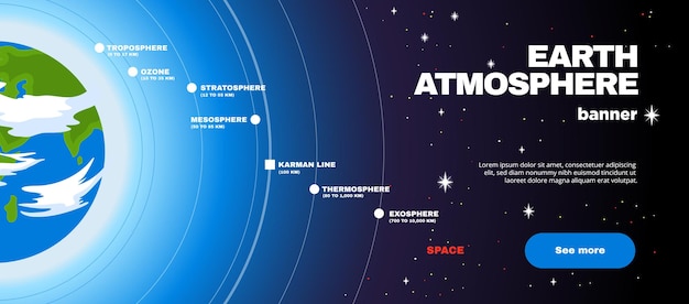
The world above us is more than just the blue sky. There is a whole host of atmospheric layers that make up our atmosphere. Learning about the stratosphere, troposphere, mesosphere, and thermosphere will help you understand these levels better. So let’s get started!
Overview
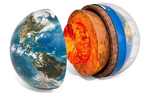
Structure of planet Earth with atmosphere layer concept, 3D rendering. Photo: iStock
In the image above, we see the Earth’s inner core, outer core, mantle, upper mantle, crust, and the atmosphere.
The atmosphere can be broken up into several different layers; some of which are further subdivided. The different layers are mainly determined by the wavelength of light measured in each layer. For example, light with a shorter wavelength (blue light) cannot travel as far as light with a longer wavelength (red light).
This article will explore the following topics:
The Troposphere
The troposphere is the first layer of the atmosphere that spans from the Earth’s surface to about 10-18 kilometers. This is where most weather phenomena occur, such as rainfall, thunderstorms, and dust storms. The air temperature in this layer is fairly constant and rarely drops below -40 degrees Celsius or rises above 40 degrees Celsius. This is because the Sun’s radiation is blocked by the Earth’s surface, preventing it from heating the layer above.
The rate at which the temperature of the atmosphere changes depends on latitude and altitude. The troposphere is thicker at the equator than it is at the poles. Also, it is thicker in the summer than it is in the winter. The troposphere is where water vapor and carbon dioxide are found in large amounts. Water vapor is responsible for the formation of clouds and fog. Carbon dioxide is known to be a greenhouse gas and is responsible for global warming.
The Stratosphere
The stratosphere is the second-highest layer of the atmosphere. It covers a large area extending from 10-36 kilometers above the Earth’s surface. The upper boundary of the stratosphere depends on latitude due to the variation in the amount of incoming energy that causes temperature anomalies in the region.
The temperature of the stratosphere is fairly constant. This is because the Sun’s radiation is being reflected back towards space by the molecules of Nitrogen and Oxygen in this layer. This is why temperatures don’t rise above -80° C up to 15 kilometers above the Earth’s surface.
The stratosphere is the layer of the atmosphere that is most affected by ultraviolet (UV) radiation from the sun. In this layer, UV radiation is absorbed by ozone molecules, turning them into oxygen radicals. These then react with Carbon Dioxide, forming Trioxynitrous Acid (CNO). This reaction produces Ozone, which is found in the highest concentrations between 7-15 kilometers above the Earth’s surface.
The Mesosphere
The mesosphere is the third layer of the atmosphere. It is a transition layer that lies between the troposphere and the thermosphere. The upper boundary of the mesosphere is 65-80 kilometers above the Earth’s surface. The lower boundary of the mesosphere is the tropopause, which is the dividing line between the troposphere and the mesosphere.
The mesosphere is very dry, and the air pressure is very low. Temperatures in this layer are between -90 degrees Celsius and -50 degrees Celsius. The mesosphere is constantly being heated by the Sun’s radiation. The thermal energy present in this layer causes it to expand and regularly contract throughout the day.
The Thermosphere
The thermosphere is the fourth layer of the atmosphere. It is the highest layer above the Earth’s surface. This layer is mainly made up of the ionosphere, which runs above it. The upper boundary of the thermosphere is about 500-1,000 kilometers above the Earth’s surface.
The thermosphere is made up of ionized gas at extremely high temperatures – up to 1,800 degrees Celsius. The extremely high temperatures of this layer are due to the Sun’s ultraviolet radiation and the release of energy from the tops of thunderstorms. The ionized gas in this layer is what causes the auroras and the glowing of the polar regions. It also shields the Earth’s surface from the harmful effects of radiation. The existence of ozone in this layer protects us from the harmful effects of ultraviolet rays.
The Existence of Ozone in the Thermosphere
Due to the extremely high temperatures in the thermosphere, ozone is broken down into Oxygen and Oxygen Radicals when it comes in contact with Hydrogen. However, when ultraviolet radiation from the Sun enters the thermosphere, it collides with different atoms (such as Nitrogen and Oxygen). When this happens, it produces Hydrogen. This Hydrogen then collides with the Oxygen Radicals and combines with them to produce Oxygen. When the Oxygen reacts with the broken ozone molecules, it is transformed into Ozone again.
This Ozone is transported by winds towards the Earth’s surface and is responsible for the formation of the ozone layer on the Earth’s surface.
Conclusion
The world above us is more than just the blue sky. There is a whole host of atmospheric layers that make up our atmosphere. Learning about the stratosphere, troposphere, mesosphere, and thermosphere will help you understand these levels better.
Many would answer war, hunger, terrorism, poverty and even death. Things like these make the havoc wrecked by natural disasters quite puny. Every once in a while we hear about a cyclone killing hundreds, a volcanic eruption that destroys villages, a severe earthquake that brings mass destruction and death or a tsunami that just sweeps away entire towns along its path.
Natural disasters are a reminder that we are only human. That even the best defenses cannot save us from the forces of nature. And the tsunami happens to be one of the most fascinating natural disasters to study.
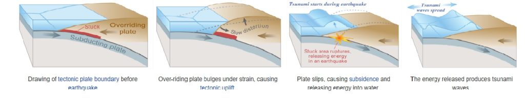
A tsunami is a sequence of oceanic waves forming due to an earthquake, a volcanic eruption or a landslide that occurs under the surface of the sea. The underwater world is a mysterious one and yes they do have mountains down there too! There are times, although rare when these waves are the result of the impact of a giant meteor that falls into the ocean.
The waves of a tsunami can reach a height of or more than One Hundred Feet!
Ever wondered what causes a tsunami?
Tsunami is a Japanese word. It translates to “harbor wave”(tsu=harbor + name=wave). The Pacific Ocean has the “Ring of Fire” which is the most tsunami prone region in the entire world, with around 80% tsunamis occurring there – a reason why Japan has a long history of tsunamis.
However, the worst tsunami in history occurred in the Indian Ocean in 2004. It was caused by an earthquake that equates to twenty-three thousand atomic bombs. The waves originating from the core of this tsunami wreaked havoc on the coastal areas of 11 different countries that included India, Bangladesh, Sri Lanka, Thailand, Indonesia, Malaysia, Myanmar, Maldives, South Africa, Kenya and Somalia. The death toll reached a tragic count of 283,000 lives.
It is observed that the first wave of the tsunami is usually not the most powerful one; the ones that follow gain strength, height and destructive momentum. The average speed of a tsunami has been recorded around five hundred miles per hour – at that speed, it can almost compete a jet plane!
In the United States, the states that are most exposed to the risk of a tsunami include Washington, Oregon, Hawaii, California and Alaska. Out of these states, Hawaii that is most prone to the tsunami. On an average, the state gets at least one tsunami each year and there is a severe one that hits them every seven years. The worst tsunami to ever hit Hawaii was one that occurred back in 1946. It hit the Hilo Island at a speed of five hundred miles per hour with waves as much as thirty feet high!
How Tsunamis are Created(Wikipedia Public Domain)
Tsunamis don’t lose their energy as they travel. They could cross entire oceans without losing their momentum. Unlike other natural disasters, it is possible to predict the estimated time for the tsunami to hit. Scientists can derive that based on a calculation related to water depth, distances and the timing of the cause.
Peanut wood is a type of petrified wood which is usually black or brown in color. It got its name from the white to cream markings which are about the same size and shape as peanuts. But before we dive into what peanut wood is and how it is formed, it is important to know what petrified wood is.
Petrified Wood
Every often, wood decomposes. But in the case of petrified wood, something which is commonly known as “wood converted into stone” occurs. When a tree turns into a fossil, it converts to a three-dimensional replacement of the plant. This happens when the actual organic matter of the tree is replaced by a silicate such as Quartz. As a result, it turns out that a tree is preserved in its original shape but changes its state and turns to stone.
Petrified wood is not rare. It is often found in sedimentary rocks or volcanic deposits around the world. It is often sold as gemstone and used as decorative material in households. Like all gem material, petrified wood is also associated with many healing properties.
How is Peanut Wood Different from Normal Petrified Wood?
Though peanut wood is a type of petrified wood, it is different from the normal petrified wood. The peanut wood we know today originated in Western Australia as a conifer tree. Over the years, when the trees died, they were carried away by the rivers into the salty sea.
This can be dated back to the Cretaceous time period. Back then, the sea into which the trees were carried was an epicontinental sea. This sea covered most of the continent which we now know as Australia. Also, during that time, there were marine species of clam which survived on wood. As the wood entered the sea, the tiny clam would swim to it and attach themselves over the piece of wood. As it was a source of food, these tiny clams would use their sharp edges of their shell to shave off small particles of wood. Within a few weeks, they could dig many deep tunnels into the wood.
As the tunnels were dug in the tree trunk, it would sink down to the sea floor. Apart from the wood eating clams, other species also survived in the water back in the prehistoric times. One particular species which aided in the formation of peanut wood was radiolarians. These are tiny plankton with siliceous shells which lived above the wood in the water. They generally thrive near the river mouth as they receive a continuous supply of nutrients. As the wood is brought to the sea, the radiolarians continue to live on the wood. But when they die, they usually sink in the water. Since their shells are made up of siliceous elements, they accumulate as a whole sediment.
Deep at the seafloor, there is wood with deep tunnels. Layer after layer, the white sediment from the dead radiolarian accumulates over the wood. Overtime, it enters the holes in the wood log Since the shells are siliceous, some of them get dissolved in the water. This concentrated silica solution enters the cavities of the wood. And then just like normal petrified wood, the organic matter of the tree is replaced with silica. Over a period of time, layers of mud and sand cover the wood and with increasing pressure the process of petrification begins. It is believed that this petrification process occurred around 120 million years ago.
However, peanut wood is different in appearance compared to petrified wood. Unlike normal petrified wood which closely resembles the original tree but is different in texture, peanut wood has white or cream peanut sized markings formed due to radiolarians occupying the bore holes in the tree.
Wood Eating Clams Today
While wood eating clams were common in the Cretaceous period, a few species of wood eating clams still live in the oceans. These wood eating clams are now known as shipworms. These shipworms have posed a threat to wooden boats for quite a long time. As the wooden boat moves around in the sea, these worm-like creatures cling onto the bottom of the boat and create tunnels in the wooden surface. This can cause serious damage especially to smaller wooden boats.
To overcome this problem, shipbuilders started using thin copper sheets to protect their ships from the damage of shipworms. But despite the measures, shipworms continue to cause structural damage to the ship.
How Peanut Wood was Found?
Millions of years ago the process of peanut wood petrification began in the region which we now know as Australia. Back then, the region was covered with sea. The seafloor which contained peanut wood was lithified into sedimentary rocks which were then known as Windalia Radiolarite. As the continental formation changed, these sedimentary rocks rose above the surface of the sea. In these rocks, peanut wood was discovered and classified as a gem material.
As this unique petrified wood was found, it soon became famous due to its distinct appearance. It was then used to make decorative items for households and commercial use.
Today, gem hunters around the world seek to find Windalia Radiolarite. It is widely sold through online auctions and gemstone websites. It is also displayed at gemstone and mineral exhibitions such as Tucson Mineral Shows. Given the easy access, people around the world can buy this surprising and interesting piece of petrified wood.
Conclusion
Peanut wood is a gem material found in the sedimentary rocks called Windalia Radiolarite. It is indeed surprising to see an ancient piece of wood that was bored by clams is now a precious gem material with multiple uses.
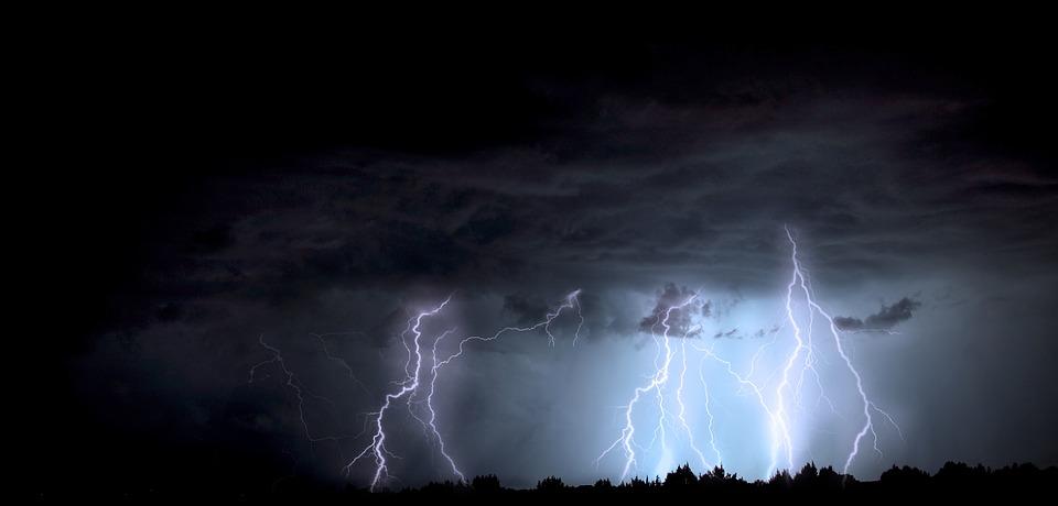
An average lightning strike contains 15 million volts of energy.
A single strike can heat the surrounding air to over 50,000 o F.
Around 100 lightning strikes hit the Earth every second. That makes around eight million strikes every day.
Unlike common belief, lightning can strike the same place twice.
The phenomena kills an average of 73 people in the US each year.
Lightning Strike
Every year, people around the world experience three billion lightning strikes but not all make contact with land. If you look at the numbers, as little as 3% of the total strikes touch the surface of the Earth. When they hit the surface, the temperature of the surrounding air rises to around 50,000 o F at that specific instance. Imagine what it can do to the surface it touches! But on a positive note, the temperature rapidly decreases. Scientists have tried a gazillion times to capture the static charges but have not succeeded so far.
According to some data, every year, around 6,000 people die as a result of lightning strikes. However, National Geographic nullifies the claim and states that not more than 2,000 people die each year.
What is a Lightning Strike and Why Does it Happen?
Lightning is basically an electrical discharge. When there is a thunderstorm, the particles of rain and at times snow particles due to very cold temperatures collide. This friction creates imbalance and in most cases, a negative charge is generated which reaches the lower parts of the cloud. Nature then comes into action to rectify this imbalance.
As a result, we see lightning. From objects on the ground like trees, steeples, even people to different objects from the surface which create positive charges, all can get affected by a lightning strike. When the negative and positive charges come in contact with each other we see a lightning strike.
As mentioned earlier, a lightning strike can be extremely hot. The temperature of the air surrounding the strike can go as high as 50,000 o F. This rapid change in temperature causes the air to expand and Bang! We hear the thunder. Since the speed of sound is lower compared to the speed of light, we can see the lightning strike first, then followed by the sound of thunder.
Types of Lightning
Lightning strikes can be classified according to how they are distributed. They can either be distributed within the clouds or can be between the clouds and the ground. Let’s take a look at each type.
Lightning Within the Clouds
Lightning within the clouds can be further divided into two types.
Intra Cloud Lightning
Intra cloud lightning is the one that happens within just one cloud ball. It generally happens on the outer sides of the cloud. The scenario is the same of negative and positive discharges. But the only difference is it never reaches the ground.
Inter Cloud Lightning
This type of lightning happens when two clouds come in contact with each other. In scientific terms, different areas in the clouds have different charges. Some are positive while others are negative. Lightning happens when negative and positive charges come in contact. This type of lightning is the most commonly occurring type of lightning.
Cloud to Ground Lightning
It is obvious from the name that this is the type of lightning which generates within the clouds but hits the ground. Though it is the least common type of lightning, this is definitely the deadliest form of lightning witnessed by humans on this planet.
A stepped leader or the negatively charged initiator descends from the top of the cloud. Along the way, more negative charges gather. But when it hits the surface, it results in a major disaster.
Another way of defining lightning is through the shapes.
Sheet Lightning
When a lightning strike occurs in just one cloud and lightens up the whole cloud, it is call sheet lightning. It happens mainly in intra cloud lightning. This type of lightning can be very rarely seen in inter cloud lightning.
Heat Lightning
This is the most common type of lightning we all witness. When lightning occurs in the sky within different clouds which come in contact with each other. As a result of interaction of the positive and negative charges, a lightning strike is created.
Staccato Lightning
Staccato lightning is a type of lightning which occurs for a very short and brief instance. It looks like a straight line with a single flash similar to a camera flash. On its way down to the surface of the Earth, it also reveals some of its branches. This happens in cloud to ground lightning.
Forked Lightning
This is also a type of cloud to ground lightning. It is a very simple lightning which has branches and all the branches touch base with the surface but the origin is the same charge.
Ribbon Lightning
This type of lightning is most common during thunderstorms. When the wind is moving fast and with cross winds when the charges come in contact, the process of lightning starts. This causes multiple strikes to hit the surface of the ground, with every strike right next to the other in the direction of the wind. Obviously this again happens during cloud to ground lightning.
Bead Lightning
This is one of the rarest types of lightning. When lightning breaks into different parts and strikes different sections in the same area with no fixed patterns, the system is called bead lightning.
There are a few more types but they are not commonly known and are very rare. In the final section, we will look into the biggest lightning disaster in history.
The Biggest Disaster Due To Lightning
The biggest disaster due to lightning happened during the times of the French dictator Napoleon Bonaparte.
As the dictator took over a small European country named Luxembourg in the early 1800s, he converted it into his backyard to store arms and ammunition. He constructed a number of bunkers and underground warehouses to stock his weapons and supplies.
On June 26th 1807, a lightning strike at one of his gunpowder factories in Luxemburg, one of the smallest countries in Europe. This factory was built in a fortress in the southern part of the country in the city of Kirchberg. The fortress was constructed in 1732 and was now being used as an armory to refill the Napoleon forces in the southern part of the country.
Subsequently the factory exploded and immediately killed approximately 300 people in the very same instance. The ammunition depot was destroyed along with the gunpowder factory. 2 blocks of the castle were destroyed, leaving everything living, dead. Several other areas nearby were also burnt and huge quantities of armor were also destroyed. So it can be concluded that what appears to be Nature’s lightning show is something which can be extremely dangerous and deadly.
Generally, lakes are considered to be a source of fresh water. How fresh is your water? Or more specifically, for the benefit of this article, how fresh is lake water?
All water is measured by a scale called ‘pH’, which determines how much of a unit of water is acidic and the acidity rating (pH) is determined by how much hydrogen is in that unit of water.
There is no indication that a reasonable amount of acidic water is bad for you however; indeed, it may have a number of benefits, including being used as a disinfectant and in this world of coronavirus, it may be advantageous to help keep your house and food clean.
The pH range goes from 0 to 14, with 7 being neutral (no acidic content), so pHs of less than 7 indicate acidity. But that does not always mean that water everywhere around the world has a pH of seven. Instead, the pH level in many lakes and rivers are between six and nine.
But there are certain water systems where the pH of water is less than five. This means that they are acidic and this can be a result of various reasons, but mainly, one can classify them into two main causes.
The first reason will be the presence of acids in the water or there has been an inflow of acids from some external sources. This occurs when acidic industrial waste is dumped into the rivers and lakes which eventually increases the acidity of the water. Another external source would be acid rain in the region.
The second reason is simpler. There is a lack of alkaline bases in the water stream.
Acid lakes are often located near areas of granitic bedrocks, siliceous bedrocks and active volcanoes. Certain areas which are marked by researchers as areas which receive acid rain are also some of the common sites of acid lakes. The eastern parts of the US are considered to be areas that receive a high content of acid rain which disturbs the natural alkaline balance in the lakes.
Acid Lakes Around the World
Some of these lakes are so acidic that the water is strong enough to dissolve a person’s skin. But one of the largest acid lakes is located in Indonesia. Unlike other acid lakes, this lake has turquoise waters that appear to be calm and serene but are actually highly acidic.
Ijen Volcano, Java
This volcano complex is located on the border between Banyuwangi regency and Bondowoso regency of East Java. The Gunung Merapi is the highest point of that complex. This name means mountain of fire in the local language. Among this volcano complex is the Kawah Ijen volcano which is a famous tourist attraction. The reason for it being famous is the electric blue glow that comes out of it. The reason for this is the constant sulfuric gas which is present in the volcano. When the gas comes in contact with oxygen in the air, a stunning blue glow is produced.
Apart from the blue glows, the most important thing which the crater is known for is the world’s largest acid lake it holds. The lake is turquoise in color. It has a yellow tinge to it that makes it even more beautiful. This yellow is basically due to the presence of high sulfur content. On the pH scale, the pH of water in this lake is as low as 0.3 which means it is extremely acidic. You can compare the acidity of this water by the fact that lemon juice has a pH of 2 whereas the pH of water of a car battery is 1.
It is a crater lake inside around a 12 miles crater in East Java. It lies between the Ijen Volcano Complex which is a group of stratovolcanoes with a long history. The lake around the crater is around 600 feet deep and holds around 1,130 cubic feet of turquoise water. Due to the high acidity of the water, the water is not suitable for drinking purposes and has a pungent, bitter taste.
However, the lake remains a famous tourist attraction. Though one cannot swim in it, tourists often visit this place to watch the 15 natural waterfalls which connect with this lake and there is a cruise also allows tourists to take a tour of the lake and connecting rivers. However, it is extremely important to take precautions as you cruise through the lake. The high acidity can cause severe allergic reactions on the skin and eyes. In some cases, it can also result in respiratory issues.
The extreme acidity has affected the nearby river water including river Banyu Pahit. When the water from this lake joins the Banyupahit River, it changes the pH level. According to research done in 2017, it is in a bracket of 2.5 and 3.5 pH on average. There is also a high amount of metal particles such as iron and aluminum. Though the river water is less acidic compared to the lake, it is still not safe for human consumption without treatment.
The government in Indonesia has taken steps to reduce the acidity of the water. They are using techniques such as filtration and reverse osmosis to increase the pH level of the river. This is done to ensure that the negative impact of acidic water can be minimized.
As mentioned earlier, the reason for the high acidity of this lake is the presence of high sulfur content. This sulfur provides a source of income to the local population. In fact, most of the locals are associated with sulfur mining.
Conclusion
There are many other acid lakes spread throughout the world but Ijen volcano Crater Lake is the most acidic lake known on this planet. While the water of the lake is not suitable for irrigation or human consumption, it is a source of employment for hundreds and thousands of people associated with sulfur mining.
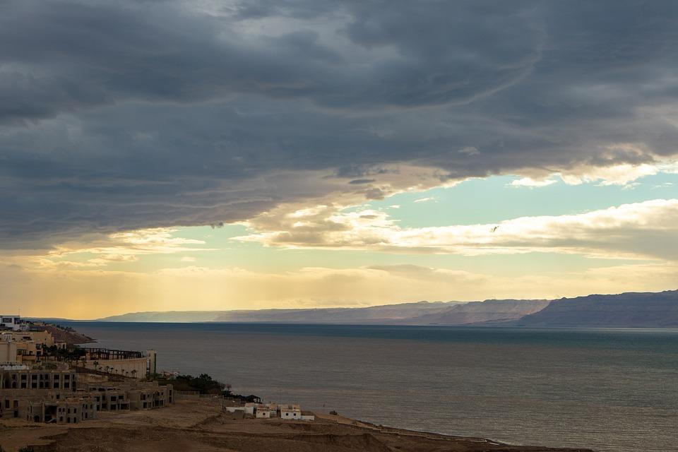
Is it possible for some parts of the world to exist below sea level? The answer is yes. Sea level is the average level of the Earth’s surface which is used as a parameter to measure the planet’s elevation. There are multiple locations that have a negative attitude when compared to sea level. In the post below, you will find out about six such locations that are indeed unique.
The Dead Sea – Israel, Jordan
The lowest point or the deepest place on Earth is the Dead Sea in the Jordan Rift Valley, bordered by Isreal on the west and Jordan on the east. It is a famous tourist destination where people visit to explore the uniqueness of this sea.
The known depth of this point compared to sea level is almost 1,355 feet (413 meters) however, the parameter can be complicated due to various weather conditions. It depends upon the rate of precipitation and the level of water evaporation from the sea. In case of a drought, when there is limited rainfall and evaporation rate is high, the depth of this lowest point can reach its maximum which is 1,355 feet below sea level. After the rainfall, the depth can be decreased by a few feet.
The distinguishing feature of this coast is the high salt content which forms for the incredibly unique natural landscape. The high concentration of salt attracts tourists due to health reasons. It is believed that salt water can cure numerous diseases and conditions of the skin.
The reason for excessive salt concentration in this sea is the presence of salt rocks during the oceanic water. Due to higher levels of evaporation of the water from the sea, the salt rocks are exposed even at the coast. Also, these salt rocks are the reason for the formation of natural landscapes and sculptures. So tourists who visit this place not only enjoy the unique formations but also benefit from the assumed healing properties of the water from this deepest point on Earth.
Lake Assal, Djibouti
The second-lowest point is the Lake Assal in Djibouti. An East African country located in the Horn of Africa on the Gulf of Aden. It is situated at the bottom of a crater lake which is almost 509 feet (155 meters) below sea level.
This lake is a part of the larger region known as the Afar depression which extends well into Ethiopia. It was described by National Geographic as the cruelest place on Earth due to extreme climatic conditions. Similar to most other lowest points, Lake Assal is characterized by high temperatures, desert and a volcanic landscape.
The Turfan Depression
The third lowest point below sea level is Turfan Depression, a location in China with a depth of 505 feet (154 meters). This, however, is the average depth of the area and the exact depth varies with climatic conditions. Despite the hot and dry climate, there is a salt lake at the bottom of this depression. In the northern part of this depression is a small oasis city known as Turfan.
Based on the archaeological research, it is believed that the area was inhabited by humans in the 10th century. Today, this is an important historical site for tourists who can enjoy the remains of the early civilization along with the evidence of the last volcanic eruption in the 12th century. It is also believed that the high level of volcanic activity over the number of years has also contributed towards the formation of this depression.
This depression also experiences the similar weather conditions as the Lake Assal. The summers are hot and dry and temperatures in the region can spike up to 104 oF. During the summers, this deepest point in South Asia and China is always dry so is the salt water lake at the bottom of this depression.
Qattara Depression
Another deepest lowland is again found in the African continent. With a depression of 436 feet (133 meters) below the sea level, the Qattara Depression forms one of the lowest points in Africa. After extensive research of this region, the archeologists believe that the region was never inhabited due to the extreme weather conditions and lack of water. The average annual rainfall in the region is as low as 2.1 inch. During summers, the temperature can rise as high as 97 oF. The extensive heat and lack of rainfall results in the prevention of water basins however, the distinguishing feature despite high temperatures in the breeze which does not stop at any time of the year. Today, only a few nomads can be found in the region.
Caspian Depression, Kazakhstan
The largest enclosed body of water in the world is the Caspian Sea which is also one of the lowest points below sea level. The shore of this depression is almost 92 feet (28 meters) below sea level. The sea strands its borders with countries of the U.S.S.R region including Azerbaijan, Turkmenistan, Russia and Iran. Unlike its name Caspian Sea, the Caspian Sea is not a sea or part of the ocean but is a salt water lake with no natural outflow. This lowland depression includes the Northern Part of the Caspian Sea.
Danakil Valley
Another lowland in Africa is the Danakil Valley. It is located in Ethiopia and is referred to as Danakil desert. The valley is unique because it is located at the border of the three large tectonic plates including the African plate, the Indian Plate and the Arabic Plate. This valley is considered to be one of the most dangerous places in the world. This is not only due to extreme temperature and weather conditions but also due to the poisonous landscapes. The valley is known for its constant volcanic eruptions which are accompanied with sulfurous water. Together, it forms a dangerous landscape releasing toxic fumes that too at a depth of 410 feet below sea level.
This extremely hot and dangerous valley was not known until 1928 when a group of travelers first identified this location. This group of travelers which was led by Tullio Pastori managed to cross the valley on foot. To date, no other group of travelers have managed to accomplish this. As of now, this valley is a tourist destination but only for those courageous enough to survive in extreme conditions. It is here that you can witness the continuous eruptions of lava which have been spreading since many years.
Conclusion
Lands below the sea level not only have a unique landscape but also have distinct weather conditions which are much different from that on the surfaces at sea level. There are many other lowlands of Earth. Some of the most famous ones not included in this list are the Death Valley and the Salton Trough.